Africa: 30.4 million km², about as large as Russia, Canada and India together
Africa is about 14 times larger than Greenland and about 3.1 times larger than the United States, yet on the Mercator map Greenland looks slightly bigger. It is home to 1.55 billion people, second only to Asia.
- Area
- 30.4 million km² editorial estimate
- Population
- 1.55 billion World Bank, 2025
- Population density
- 51 per km²
- Entries in our catalogue
- 55 Western Sahara included
- Highest point
- 5,895 m Kilimanjaro
- Largest country
- Algeria 2,381,741 km²
- Sea level that covers half the land
- +501 m the sea-level globe
How big is Africa compared with Russia, the USA and China?
Africa covers about 30.4 million km² (an estimate for the whole landmass). That is about 1.8 times Russia, 3.1 times the United States, 3.2 times China and 3 times Europe. It is split into 54 UN Member States and Western Sahara, from Algeria (2.38 million km²) to Seychelles (460 km²).
| Place | Area | Africa is larger |
|---|---|---|
| Russia | 17,098,246 km² | 1.8 times |
| Canada | 9,984,670 km² | 3 times |
| United States | 9,833,517 km² | 3.1 times |
| China | 9,600,000 km² | 3.2 times |
| Greenland | 2,166,086 km² | 14 times |
| France | 551,500 km² | 55 times |
| Poland | 312,679 km² | 97 times |
Total area of the countries from the UN Demographic Yearbook 2024; Africa is an editorial estimate.
What fits inside Africa?
Three countries are enough: Russia (17.10 million km²), Canada (9.98 million km²) and India (3.29 million km²) add up to 30.37 million km², practically the whole of Africa.
It is a sum of areas, not a puzzle: the shapes would not tile.
Why does Africa look smaller than it is on the usual map?
The Mercator map draws the equator at true scale and stretches area more the closer it gets to a pole. Africa lies on both sides of the equator, so it is stretched by only about 12% on average. Greenland, far in the north, is stretched about 16 times. That is why it is drawn about 6% larger than Africa, although Africa is about 14 times larger than it.
Africa's largest, most populous and most crowded countries
Algeria is the largest country (2.38 million km²), ahead of the Democratic Republic of the Congo and Sudan. The most people live in Nigeria (237.5 million), Ethiopia and Egypt: together almost a third of all Africans. On average about 51 people live on each square kilometre, but the spread is huge: Namibia has 3.8 per km², while Rwanda is the most crowded country on the mainland (591 per km²). The island country of Mauritius is denser still (623 per km²).
| Country | Area | Population |
|---|---|---|
| Algeria | 2,381,741 km² | 47,435,312 |
| Democratic Republic of the Congo | 2,345,410 km² | 112,832,473 |
| Sudan | 1,878,000 km² | 51,662,147 |
| Libya | 1,759,540 km² | 7,458,555 |
| Chad | 1,284,000 km² | 21,003,705 |
| Niger | 1,267,000 km² | 27,917,831 |
Population: World Bank, 2025. Density is population divided by land area.
How much of Africa is the Sahara?
The Sahara covers about 9 million km² (sources give 9.0 to 9.2 million km², depending on where the desert ends), around 30% of Africa. That is a little less than China (9.6 million km²) or the United States (9.83 million km²).
The Nile, the Congo, the Niger and the great lakes: Africa's water
The Nile is 6,650 km long and, by most sources, the longest river in the world, a title the Amazon disputes. Among the African lakes, Lake Victoria is the largest by surface (68,800 km²) and Lake Tanganyika the deepest (1,470 m).
Africa: rivers and lakes from our atlas
Rivers
- RiverNile6,650 km · basin 3,349,000 km²
- RiverCongo4,700 km · basin 3,457,000 km²
- RiverNiger4,200 km · basin 2,240,000 km²
Lakes
Kilimanjaro and Lake Assal: the extremes of Africa
Kilimanjaro in Tanzania (5,895 m) rises highest, and the lowest ground is Lake Assal (Djibouti), about 155 m below sea level. More than 6 km of height lie between them, though both are in the east of the continent, about 1,700 km apart.
Raise the sea on the globeHow did Africa get its shape?
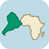
Africa was once the heart of Gondwana, joined to South America, Antarctica, Australia and India. Gondwana later became the southern part of Pangaea, whose time is often summarised as about 300 to 200 million years ago. On the continental drift map, move the age slider and watch those lands drift apart.
Countries and territories: Africa in our catalogue (55)
- Algeria
- Angola
- Benin
- Botswana
- Burkina Faso
- Burundi
- Cabo Verde
- Cameroon
- Central African Republic
- Chad
- Comoros
- Democratic Republic of the Congo
- Djibouti
- Egypt
- Equatorial Guinea
- Eritrea
- Eswatini
- Ethiopia
- Gabon
- Gambia
- Ghana
- Guinea
- Guinea-Bissau
- Ivory Coast
- Kenya
- Lesotho
- Liberia
- Libya
- Madagascar
- Malawi
- Mali
- Mauritania
- Mauritius
- Morocco
- Mozambique
- Namibia
- Niger
- Nigeria
- Republic of the Congo
- Rwanda
- Sao Tome and Principe
- Senegal
- Seychelles
- Sierra Leone
- Somalia
- South Africa
- South Sudan
- Sudan
- Tanzania
- Togo
- Tunisia
- Uganda
- Western Sahara
- Zambia
- Zimbabwe
Explore Africa further
World ExplorerTravel from country to country: answer a question about each one to take it, then walk on to its neighbours.
The other continents
Africa: frequently asked questions
How many times larger is Africa than the United States?
About 3.1 times. Africa covers about 30.4 million km² (an estimate), the United States 9.83 million km².
Is Africa bigger than Russia?
Yes, about 1.8 times. Russia, the largest country in the world, covers 17.10 million km², and Africa about 30.4 million km².
Is Africa the second largest continent?
Yes, and the second most populous too. Only Asia is larger (44.6 million km²) or more populous. Africa has about 1.55 billion people.
How many countries are there in Africa?
Africa has 54 UN Member States. Our catalogue lists 55 entries for it, because it also shows Western Sahara (a territory of unresolved status).
Why does Greenland look as big as Africa on a map?
It is an effect of the Mercator projection, which stretches areas the closer they lie to a pole. Greenland is stretched about 16 times, Africa by only about 12%. In reality Africa is about 14 times larger.
Which is the largest country in Africa?
Algeria, at 2.38 million km². It is followed by the Democratic Republic of the Congo (2.35 million km²) and Sudan (1.88 million km²).
Sources and definitions: Country areas: UN Demographic Yearbook 2024. Population: World Bank, 2025. Heights and depths: the measurements and lists named in the text (among them the joint Nepal and China survey of 2020, the National Park Service, Britannica). Antarctic ice sheet: Australian Antarctic Division. Antarctic Treaty: Secretariat of the Antarctic Treaty. Territorial claims and people at the stations: Australian Antarctic Division. UN Member States: United Nations (UN News, 2011). Cold record: WMO. Outlines: Natural Earth, public domain. Data methodology.