Answer three short questions about your map's purpose, and the finder picks a projection, explains why and shows what to avoid. You don't need to know terms like equal-area or conformal.
Every flat projection distorts something, so the choice depends on what the map has to show faithfully. The finder turns your goal into one of four properties and only then picks a projection from our catalogue.
The four properties you choose between
A flat map can keep one of these properties, but not all of them at once. The examples in the table come from the same classification the projection guides show.
Projection classes, what they keep and examples from the catalogue
Class
What it keeps
Good for
Examples in the catalogue
Equal-area
Area ratios across the whole map
Comparing sizes, data maps
Gall-Peters, Mollweide, Equal Earth, Werner Projection, Interrupted Goode Homolosine
Conformal
Angles and shapes at a small scale
Navigation, web maps
Mercator, Peirce Quincuncial, August Epicycloidal, Spilhaus Projection
A sphere cannot be laid flat without stretching, just as an orange peel cannot be flattened without tearing. Every world map has to give something up: an equal-area projection distorts shapes, a conformal one distorts areas, and a compromise distorts a little of everything.
That is why “which projection is best?” only makes sense together with “for what?”. A map that is ideal for navigation misleads a lesson on continent sizes, and an equal-area map cannot draw the shortest flight route as a straight line.
What the finder is based on
The selection rules build on John P. Snyder's guidelines in the 1987 USGS manual “Map Projections: A Working Manual” and on the Projection Wizard tool by Bojan Šavrič, Bernhard Jenny and Helen Jenny. Those tools ask for the property directly. This finder starts from the goal, and the “I know the terms” mode lets you pick the property yourself.
The finder covers world and hemisphere maps. Maps of single countries and regions need conic, azimuthal or transverse Mercator projections fitted to the area. They are not in our map lab yet, so the finder says so plainly when you choose one.
Frequently asked questions
Which projection is best for a world map?
There is no single best one. For comparing sizes and for data maps choose the equal-area Equal Earth, for a wall the compromise Winkel Tripel, and for navigating on a constant course the Mercator projection.
Why does Google Maps use Mercator if it distorts area?
Because web maps mostly show small areas, and Mercator keeps angles and shapes at a small scale. Streets meet at the right angles on it at every zoom level. The flaw only shows when you zoom out to the whole world.
After the UN resolution, should I always use Equal Earth?
No. The resolution of 4 September 2026 is non-binding and encourages equal-area maps where continent sizes are compared. For navigation, web maps or routes other projections still work better.
Can the finder pick a projection for a map of one country?
Not fully yet. It explains that a country map needs a different family of projections and, for Poland, names the official PUWG 1992 system (EPSG:2180), based on the transverse Mercator projection. Regional projections are planned for the map lab.

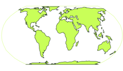 Equal Earth
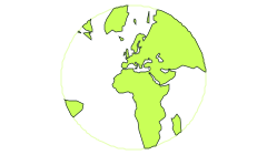 Gnomonic
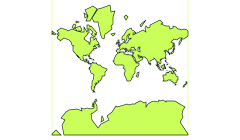 Mercator